Related Guides
Norman B. Leventhal Map Center at the Boston Public Library
Sanborn Fire Insurance Maps

Click to enlarge and zoom.
Sanborn Fire Insurance Maps of Massachusetts: Boston
Black and white-
Mugar Microforms HG9778. M37 S45 (basement; staff will help you print hard copies)
Reel 4: 1887, v.2 Back Bay – South End/Sections 29-59
Reel 5: 1897, v.2 Back Bay – South End – North Dorchester/Sections 1-83
Color-
Harvard University Digital Resources
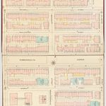
[City proper]. 1885 [v.2 [Back Bay and South End]. 1887 (seq. 30-59)]. Digitized from original books. No restrictions on access copy. Sheet 31 shows Back Bay.
Norman B. Leventhal Map Center
Sanborn Map & Publishing Company 1885
-
Mapping Boston by An informative--and beautiful--exploration of the life and history of a city through its maps. To the attentive user even the simplest map can reveal not only where things are but how people perceive and imagine the spaces they occupy. Mapping Boston is an exemplar of such creative attentiveness--bringing the history of one of America's oldest and most beautiful cities alive through the maps that have depicted it over the centuries.The book includes both historical maps of the city and maps showing the gradual emergence of the New England region from the imaginations of explorers to a form that we would recognize today. Each map is accompanied by a full description and by a short essay offering an insight into its context. The topics of these essays by Anne Mackin include people both familiar and unknown, landmarks, and events that were significant in shaping the landscape or life of the city. A highlight of the book is a series of new maps detailing Boston's growth. The book also contains seven essays that explore the intertwining of maps and history. Urban historian Sam Bass Warner, Jr., starts with a capsule history of Boston. Barbara McCorkle, David Bosse, and David Cobb discuss the making and trading of maps from the sixteenth to the nineteenth century. Historian Nancy S. Seasholes reviews the city's remarkable topographic history as reflected in maps, and planner Alex Krieger explores the relation between maps and the physical reality of the city as experienced by residents and visitors. In an epilogue, novelist James Carroll ponders the place of Boston in contemporary culture and the interior maps we carry of a city.
Call Number: Mugar Folio GA430 .M36 1999
Back Bay: A Historical Narrative Through Map Observations
-
Back Bay: Changes Through TimeFrom The Once and Future City. M.I.T. School of Architecture & Planning

